Dynamic Apps

Basemap Updates
Regular updates ensure that the basemap accurately reflects the current state of the to; accuracy is crucial for informed decision-making

Zoning Public Portal
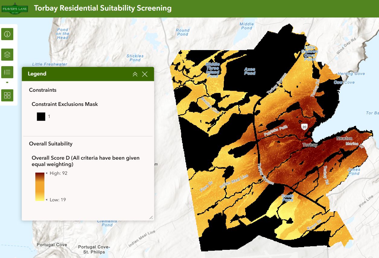
Multi-criteria Decision Analysis
Recommend suitable areas, in this case for residential housing development, based on weighting and spatial overlay of relevant factors

Your App

Asset Management
Asset mapping to support operations including inspections, maintenance, and investment planning
Static Maps and Related Services
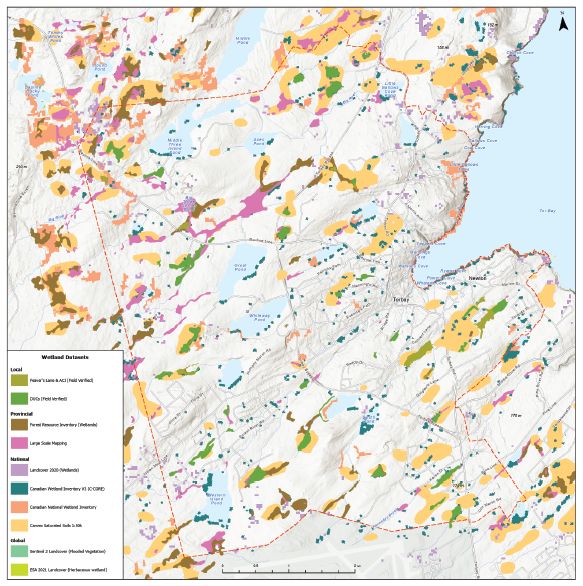
Large-format Maps
Support in-person consultations with maps for communications and markup, in this case for input on wetland delineation

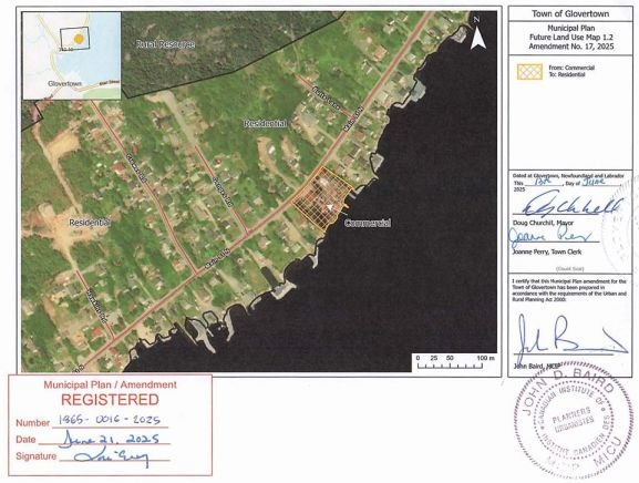
Zoning Maps
Illustrate municipal zones, land use classifications, and development regulations with new, updated or reconstructed maps

Your Map
Related Services
Needs assessment
Land use analysis
Emergency services
Property/survey digitization
Street cleaning schedule
Garbage collection routing
Database management
Software training